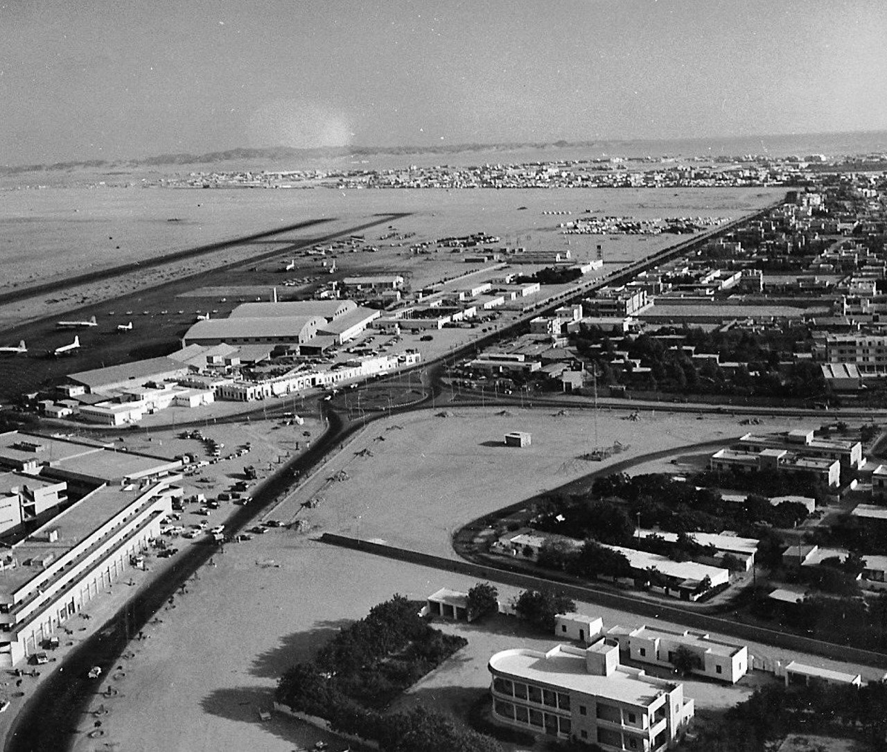

In this 1938 aerial photograph, Jeddah appears as a compact field of rooftops beside the water. The edge of the built-up area is especially striking. The National Council on U.S.-Arab Relations describes the view as looking northwest across the historic city. Study it before an Al-Balad walk, then return to it afterwards. The same photograph can help you understand both the shape of the old city and why it is difficult to see that shape from within a narrow lane.
Begin at the edge of the built-up area
Follow the dark curve in the lower part of the image. The houses are tightly packed on one side, while much of the ground visible beyond it is more open. This gives you a reliable starting point for looking at density. Identifying every segment of the historic wall requires other records and a sharper reference. Start with the contrast you can see in the image before trying to assign present-day street names or historical names to individual features.
Next, trace the water along the left of the frame and beyond the main cluster of buildings. Compare the distance between buildings and water in two or three places. In some parts of the image the built area seems to come close to the shore. Elsewhere a more open space is visible between them. That comparison offers a concrete way to think about the waterfront’s relationship to old Jeddah, even if much of your visit today takes you through lanes where the sea is out of sight.
Read the rooftops before naming buildings
Choose a small group of roofs in the centre and look at how the shadows collect in the gaps. You can see traces of movement through the built area, though the angle and resolution limit how far you can follow any one lane. UNESCO identifies the tall merchant houses as part of the architectural character of Historic Jeddah. That context helps explain why a photograph of clustered buildings is worth examining closely. Identifying a specific house still calls for a map, an address or a separate archival view.
Use the 1945 map as a second reference
A map helps you follow recorded lines and labels. The photograph shows how masses and empty spaces appeared at a particular instant. Open the site’s guide to the 1945 map of Jeddah in Arabic and begin with broad relationships such as the shape of the built-up area and its proximity to the coast. The records are seven years apart and depict the city in different ways. Treat a close match between individual buildings as a question to check, rather than an automatic result of placing the two views side by side.
Bring the photograph into a walk through Al-Balad
Save the image link before setting out and open the full version. Pick three details to keep in mind, such as the crowded roofscape, the transition to a wider space and the position of the water. While walking, notice where nearby facades close off your view and where a wider street or square gives you room to look across several buildings. The photograph puts those shifts in perspective. It pulls far enough back for you to see how spaces that feel separate during a walk can be part of one compact area.
If your plans include Al Arbaeen Lagoon, use the lagoon guide for the modern waterfront context. From a public viewpoint, compare what you can see today with the general relationship between the old city and the water in the aerial image. Write down one observation from the photograph and one from the visit. Keeping those observations distinct helps you avoid reading the shape of today’s waterfront directly back into the 1938 scene.
Try two frames from ground level
Make a wide photograph from a public square or a suitable pavement, then a closer one of a row of buildings or a facade. When you look at the aerial image again, see how a higher angle reveals relationships between buildings while losing smaller details such as the depth of a window or the texture of a wall. This helps explain why the archived photograph and a contemporary street photograph complement each other. Each offers a scale of observation that the other cannot easily supply.
A final comparison is to choose one claim you feel confident making from the old image, then one you would want to check in another source. You can confidently point to the crowded roofs and the broad areas of visible water. A building name or the precise function of an object near the shore needs further evidence. The exercise turns a brief look at a historical photograph into a more informed walk through the city, and it works just as well with later views of Jeddah.
Sources and image credit
National Council on U.S.-Arab Relations for the camera direction and the UNESCO World Heritage Centre for Historic Jeddah. Photograph courtesy of William Facey, via Wikimedia Commons, under CC BY 2.5. Original framing retained.
Planning a visit? Meet Adel Alsulami, your licensed Jeddah tour guide and discuss a private itinerary around your interests.